
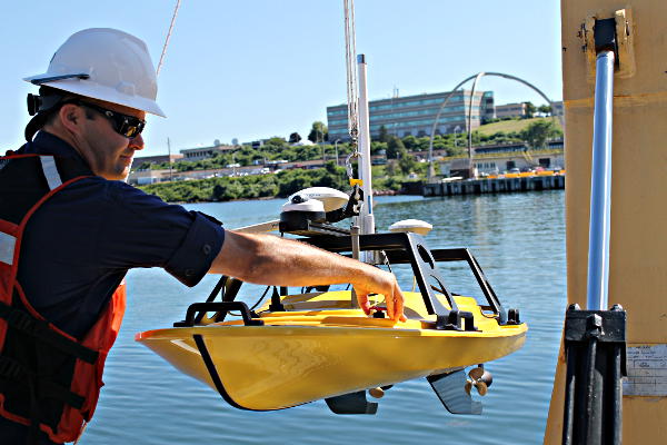
Lt. Joseph Carrier, operations officer on NOAA Ship Thomas Jefferson, deploys a Z-Boat from the ship. Photo Credit NOAA
Great news from NOAA for anyone boating in shallow water.
If you look closely at any U.S. coastal nautical chart, you’ll likely find that the areas closest to the shore, shoals, and rocks do not have updated depth measurements. In many areas, safety concerns prohibit the use of NOAA ship or launches to survey the shoalest depths. In many areas, the water is too murky to be mapped with the airborne lidar systems used in clear waters. Now, however, charting those shallow areas is about to get safer, thanks to recent purchases of small, commercial off-the-shelf, unmanned survey vessels.
This summer, NOAA Ship Thomas Jefferson will deploy a “Z-Boat,” offered by Teledyne Oceanscience out of Carlsbad, California.
The Z-Boat complements the ship’s existing hydrographic toolkit, the Thomas Jefferson’s multibeam echo sounder charts depths from 45 to 1,000 feet deep. The Z-boats can operate autonomously and chart depths as shallow as one foot safely. The Z-boats small size of 5.5 feet in length gives them great maneuverability and the ability to operate close to piling, piers and shorelines.
This new shallow water capability will allow NOAA to update areas that in many cases have not been updated in 80 or more years.
Read the full article at NOAA.
– c / m –


A great site Captn Mike. Love all the useful info.
Glad you found some useful information and articles, thanks for dropping by and subscribing
Fair winds and good seas
Yayayay.. Captain. 😀