

Seattle Harbor Chart – 1878
From //historicalcharts.noaa.gov
Have you ever wondered what the Seattle Harbor Chart looked like in 1901?
NOAA is scanning over 30,000 charts from their 150++ year history and releasing the high quality scans free to the public for Students, Historians, Researchers and anyone to download and print. The 300 dpi scans make the files a bit on the large side, however NOAA has done a good job making it easy to download the charts.
NOAA’s Historic Charts web site lets visitors search for charts by name or area on a map. I clicked on Alki Point in West Seattle and they listed almost 500 charts!
The charts are listed with a preview mode to let you see what the chart is before downloading it. The charts can be downloaded one at a time or added to a shopping cart. Don’t let the title “Shopping Cart” fool you, the downloads are free. If a chart is added to the shopping cart, all the selected charts will be put in a zip file and only one file needs to be downloaded. Also downloaded with the chart files is a text file with additional information about the selected chart.
NOAA Historic Charts home page, search image page.
NOAA has also put together a rotating collections section highlighting various historic areas and events. As I write this the collections cover Charting a More Perfect Union, 1861 – 1865, New York Bay and Harbor, Washington DC Plats and a series of maps covering part of the boundary between Alaska and Canada.
NOAA also has a links page with links to historic Coast Pilots going back to 1796, Historic current survey data, and much more as well as links to other sources of historic maps and charts and historic resources for other government agencies.
All original images are from NOAA’s Office of Coast Survey Historical Map & Chart Collection http://historicalcharts.noaa.gov
I would like to thank the entire NOAA team for the more than a decade of work so far in getting the charts available to the public, with 30,000 charts scanned and the number of charts rising every year, the sorting, indexing and making sure the best copy is scanned as well as duplicates sorted out. Truly a monster of a task. A special thanks also to Meredith Westington, Chief Geographer, NOAA/NOS/Office of Coast Survey and Nick Perugini – NOAA Affiliate, for answering several questions I had for this article.
NOAA also has over 1,000 Free BookletCharts™ available for free download in PDF format for printing yourself. BookletCharts™ are 8.5 by 11 inch reduced scale nautical charts designed for recreational and small boats.
Selected charts
I have downloaded and converted a few selected charts from the Puget Sound / Seattle area to PDF format for your convenience.
Click on the chart image to see a larger size sample image or download the PDF file.
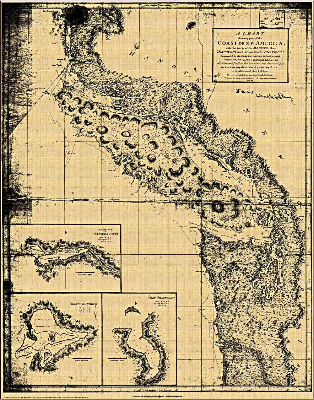
Chart from 1798 based on the George Vancouver Expedition to the West Coast
The chart from 1798 from the George Vancouver expedition is one of my favorites and the favorite of my friends and teachers. Several have the chart hanging on their walls at home or in the classroom.

Pacific Ocean – 1844
From //historicalcharts.noaa.gov
Chart of the Pacific Ocean
Exhibiting the Tracks and Researches of the U.S. Exploring Expedition. 1844

Puget Sound Chart – 1841
From //historicalcharts.noaa.gov
Puget Sound 1841
Navigation Chart of Admiralty Inlet, Puget sound, and Hoods Canal, Oregon Territory

San Juan Entrance Chart – 1866
From //historicalcharts.noaa.gov
San Juan’s
Navigation Chart of Washington Sound and Approaches, Washington Territory 1866

Seattle / West Seattle / Alki Chart – 1901
From //historicalcharts.noaa.gov
Seattle Harbor Chart 1901
Seattle / Alki Chart 1901

Seattle-Bremerrton-Chart-1948
From //historicalcharts.noaa.gov
Seattle to Bremerton Chart 1948

Seattle Harbor Chart 1879
From //historicalcharts.noaa.gov
Seattle Harbor Chart,
Puget Sound, Washington Territory 1879

South Puget Sound Chart – 1905
From //historicalcharts.noaa.gov
South Puget Sound Chart 1905
Navigation Chart of Puget Sound, Seattle to Olympia, 1905
Thanks for your interest in and support of boating safety
– c / m –


I had no idea NOAA was doing this. Thanks for the heads up. I am curious if older maps distinguish between Puget Sound and the Salish Sea.
You be welcome – everyone else did stories about NOAA getting out of the chart printing business – but I saw the little link to history – I am glad I could help a bit – we seem to loose history in this country so I am very glad that NOAA is making the charts available for the public – several of my friends live in West Seattle and they really liked the charts
I don’t know about the Salish Sea part – it still confuses me a bit
Yeah, us locals have always referred to all the salt water from the Pacific Ocean to the east as the Puget Sound. The Puget Sound is only the southern part of it.
Here’s a decent explanation of what’s considered the Salish Sea, as that’s supposed to be what’s used on maps from now on: http://www.invw.org/2009/11/salish-sea-wa-inland-waters-name-now-official/.
Thanks for the explanation & the link –
Much appreciated
Yes, now if only I could identify the northern border of the true Puget Sound…