
Great way for NOAA to extend it’s reach and detect when an area needs to be resurveyed. Also for boaters to get the benefit of “local knowledge” about changes to the sea floor before you run aground on a new shallow area.
By, Lt. Cmdr. Adam Reed, Integrated Oceans and Coastal Mapping (IOCM) Assistant Coordinator
Today NOAA announces the end of a testing phase in the development of a new crowdsourced bathymetry database. Bathymetric observations and measurements from participants in citizen science and crowdsourced programs are now archived and made available to the public through the International Hydrographic Organization (IHO) Data Centre for Digital Bathymetry (DCDB) Data Viewer. The operationalized database allows free access to millions of ocean depth data points, and serves as a powerful source of information to improve navigational products.
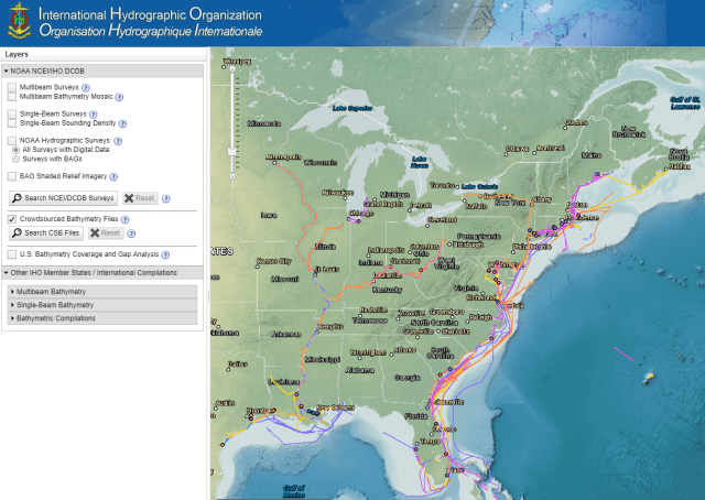 The crowdsourced bathymetry database, displayed in the IHO Data Centre for Digital Bathymetry Data Viewer, has an updated user interface.
NOAA began database development in 2014 with the IHO Crowdsourced Bathymetry Working Group. The database is part of the IHO DCDB and is hosted at NOAA’s National Centers for Environmental Information (NCEI), which offers access to archives…
View original post 600 more words

